Maps
-
Wirral Ward boundaries
A map showing ward boundaries is available on Wirral Council website.
-
Ward boundary search
Simply enter your address or postcode for details of your ward. View here.
-
Neighbourhood Care Model boundaries
A map showing neighbourhood care model boundaries is also available
-
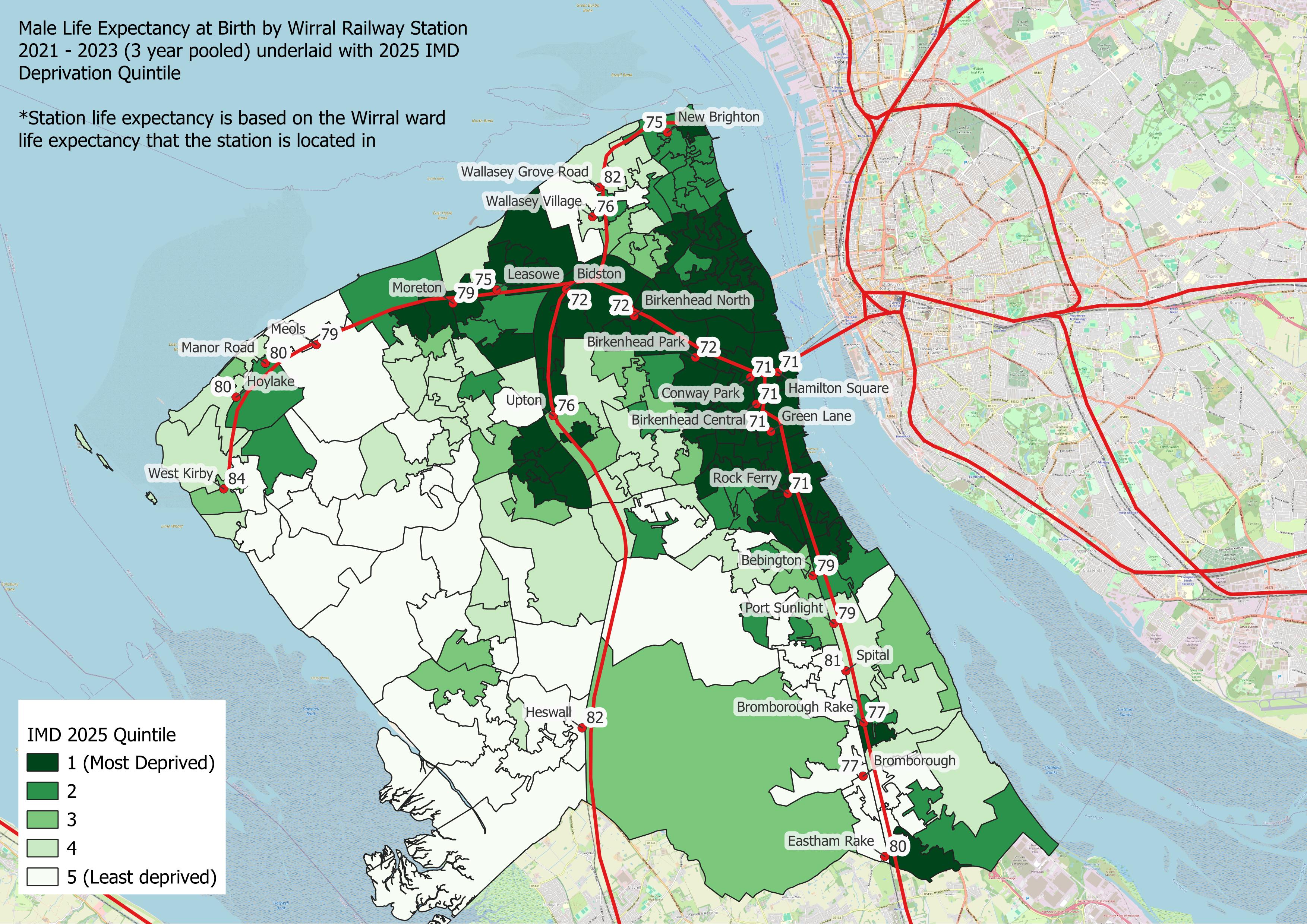
Wirral Indices of Deprivation profile
Wirral IMD Power BI profile has a range of maps describing the impact of deprivation across Wirral
-
Wirral Local Insight tool
-
Wirral Primary Care Networks
PCNs and SDUs (Service Delivery Units to Wirral Neighbourhood Boundaries
Maps are available for Wirral showing areas such as constituencies, wards and Lower Super Output Areas (LSOAs) and more (see below)
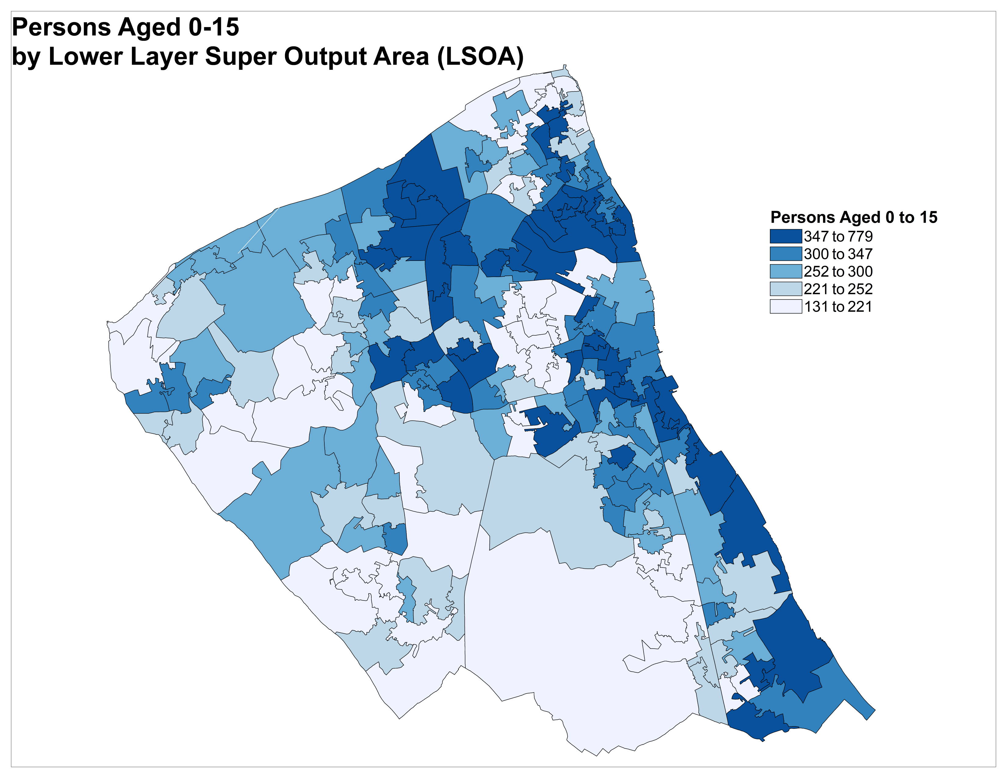
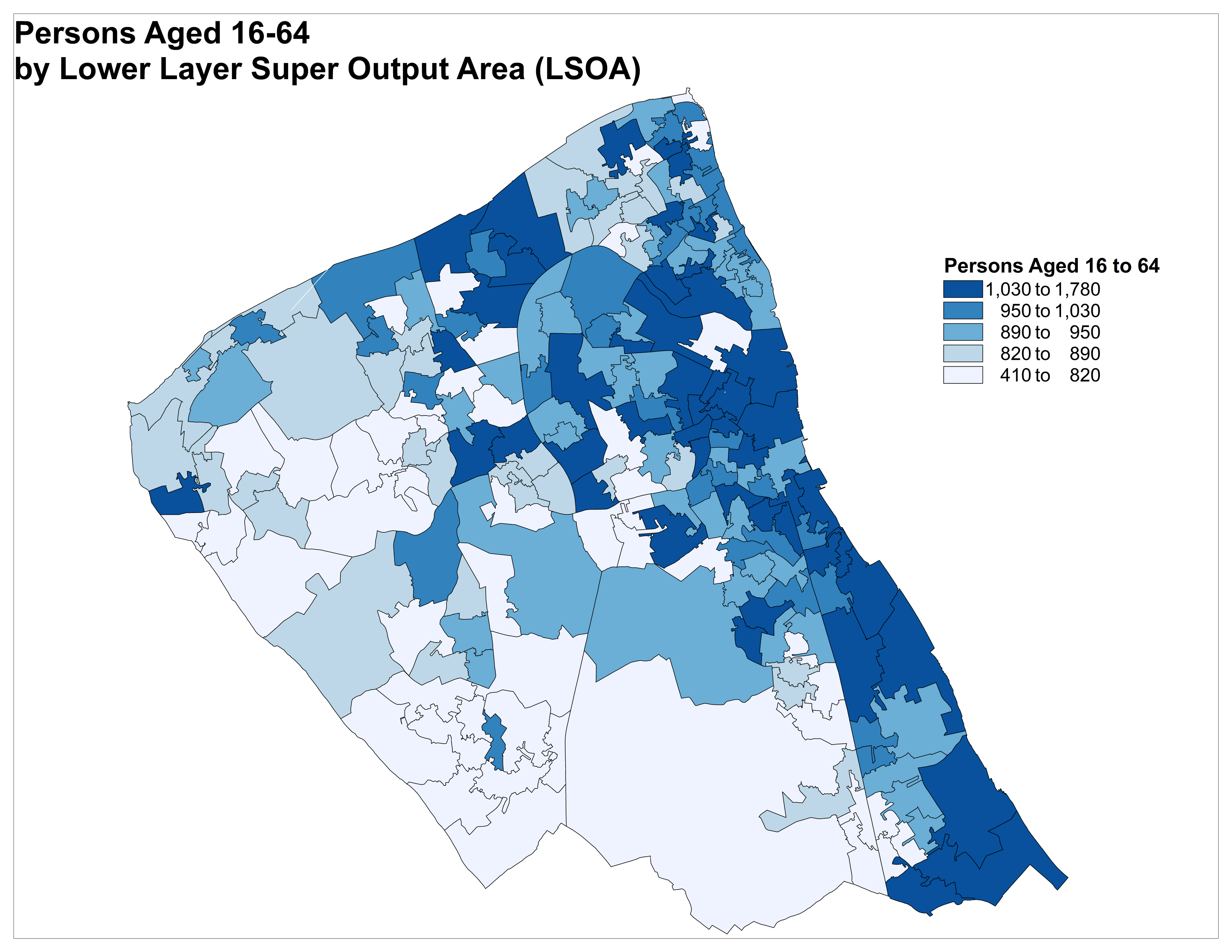
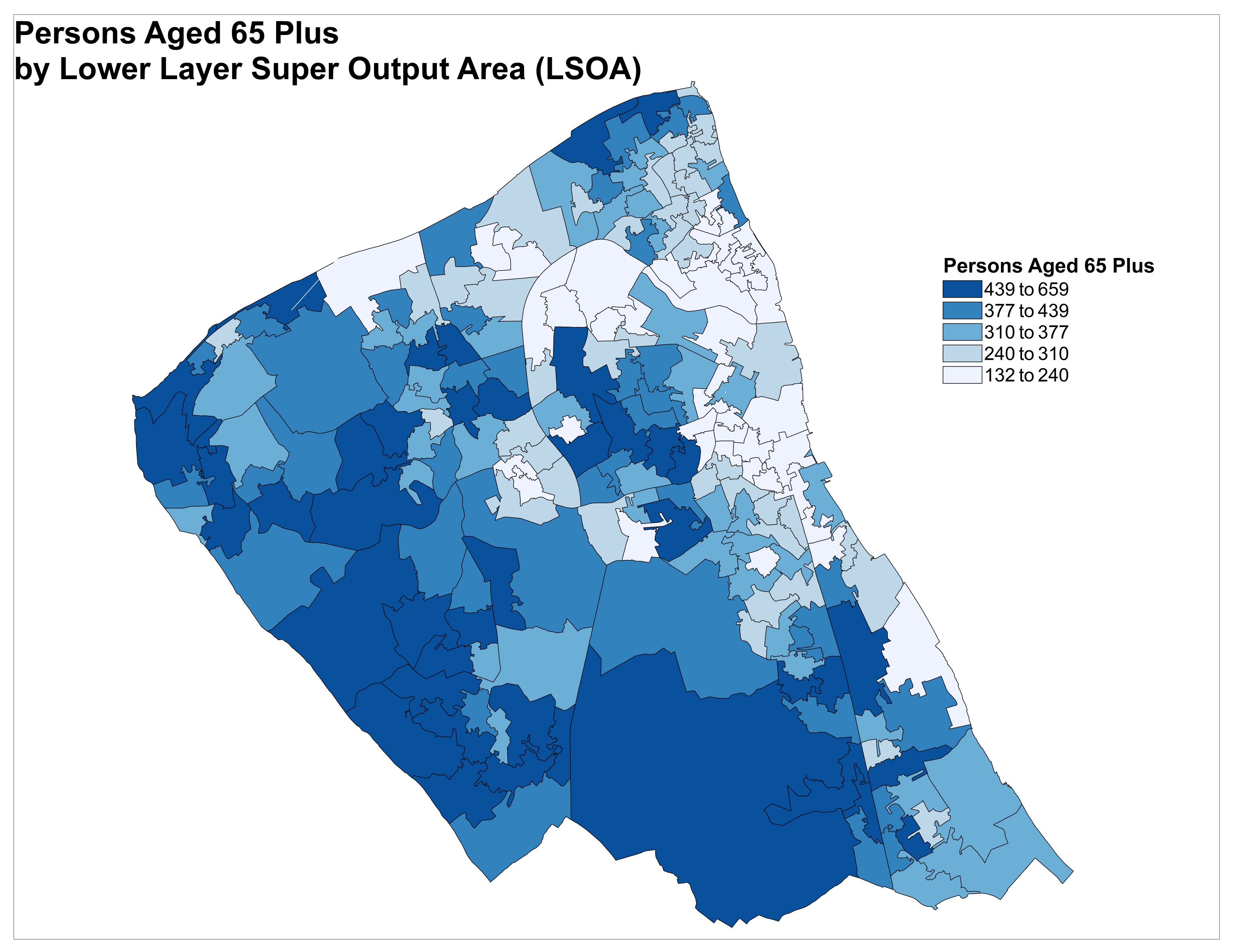
Lower Super Output Areas (LSOAs)