Maps
-
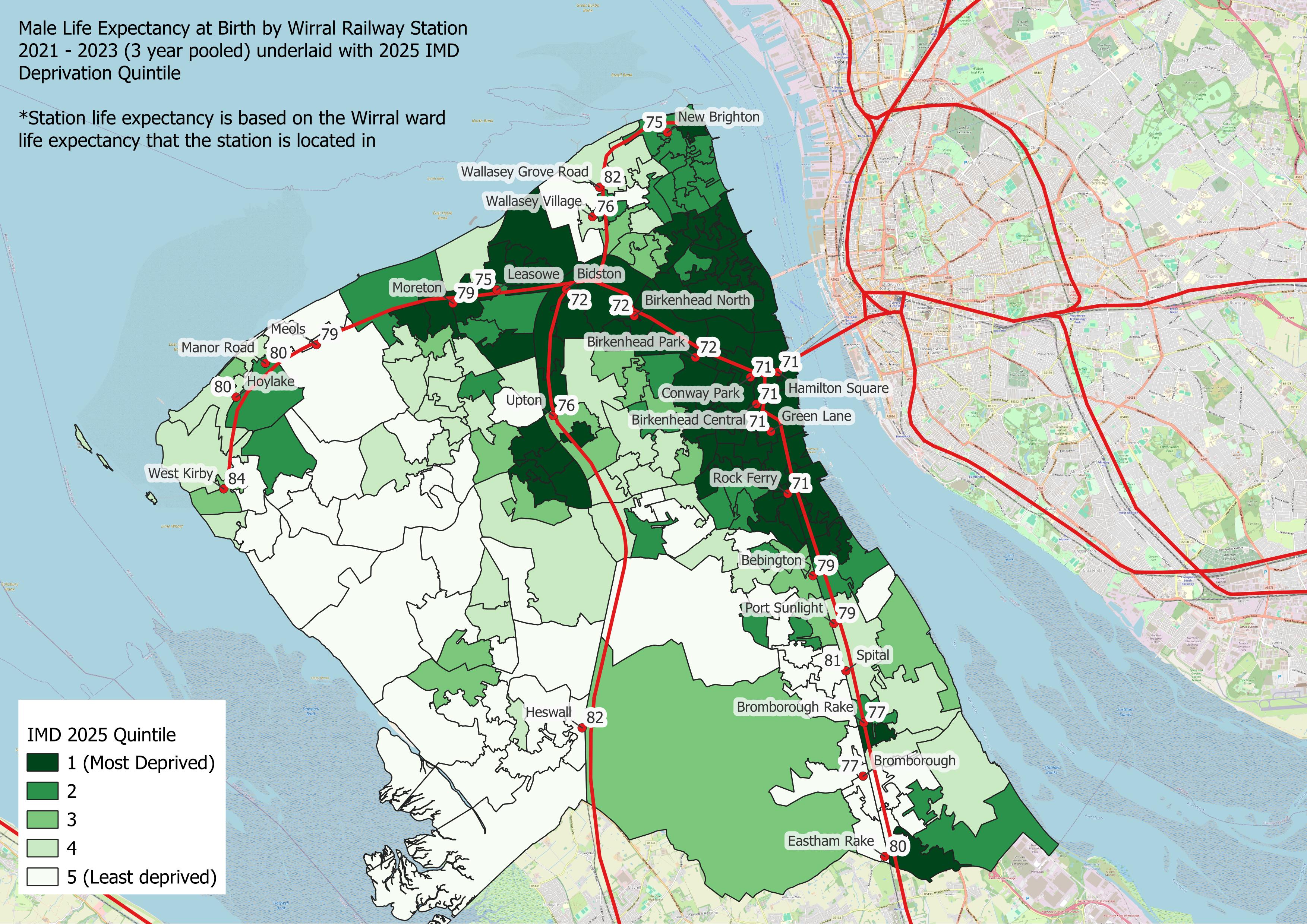
Wirral Ward Boundaries
A map showing ward boundaries is available on Wirral Council website.
-
Ward Boundary Search
Simply enter your address or postcode for details of your ward. View here.
-
Neighbourhood Care Model Boundaries
A map showing neighbourhood care model boundaries is also available - as of June 2026
-
Wirral Indices of Deprivation Profile
Wirral IMD Power BI profile has a range of maps describing the impact of deprivation across Wirral
-
Wirral Local Insight Tool
-
Wirral Primary Care Networks
PCNs (Primary Care Networks) to Wirral Neighbourhood Boundaries - as of June 2026
Maps are available for Wirral showing areas such as constituencies, wards and Lower Super Output Areas (LSOAs) and more (see below)
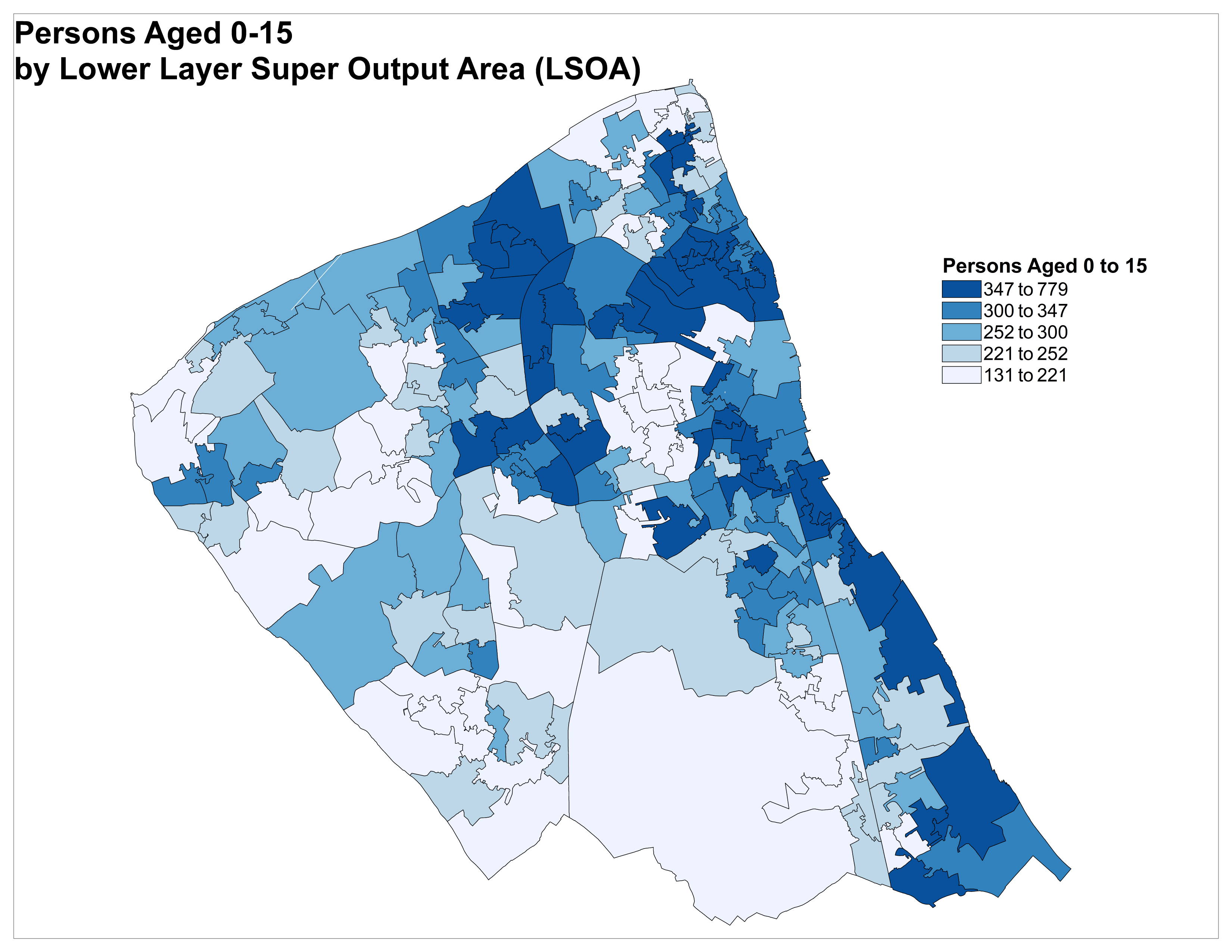
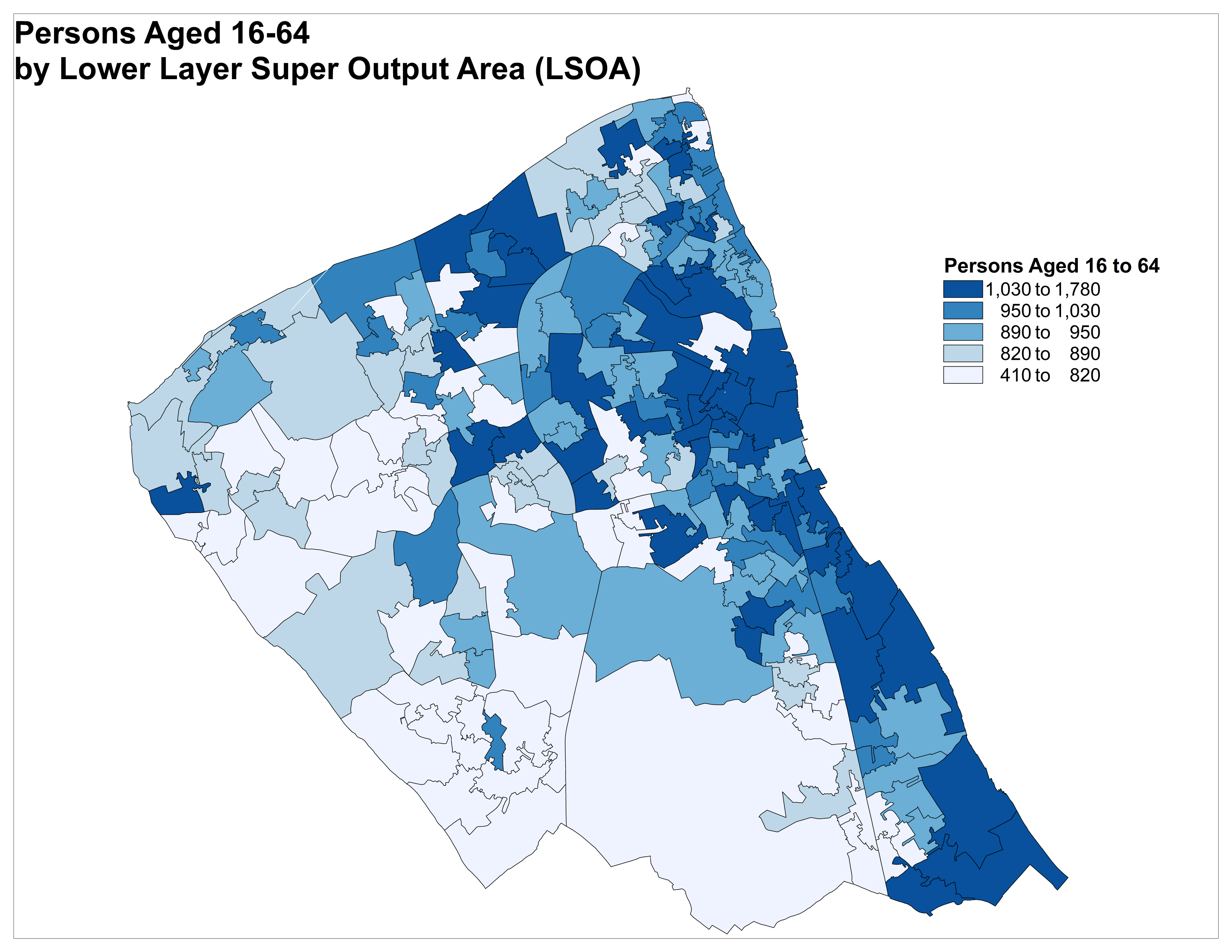
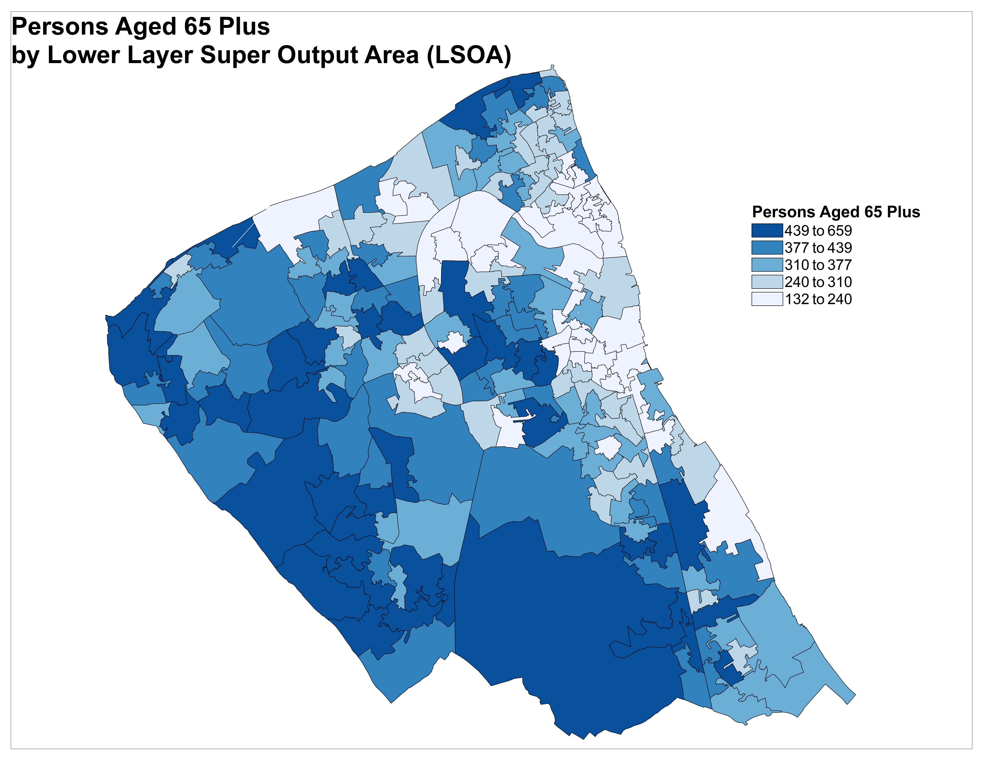
Lower Super Output Areas (LSOAs)